
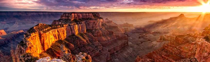
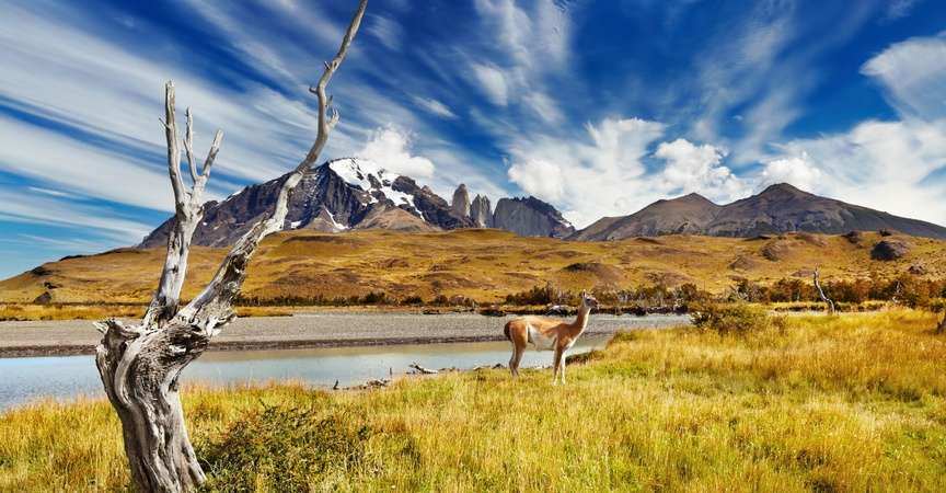
Google hopes to create the world’s most comprehensive map, combining cartographic features with HD photos and videos. Will we lose our penchant for real-life wanderings? ©Eric Rock
From taking a virtual tour of the Smithsonian National Museum of Natural History to downloading high-definition maps of national parks to checking out our own houses on Google Street View, almost all of us have been a digital navigator or engaged in simulated travel at some point in our lives. For most of us, trips today involve some sort of help or dependence on an electronic device.
In fact, using digital-only maps and traveling virtually could soon become ubiquitous, and Google seems to be sitting in the driver’s seat. The company is currently on a quest to build the world’s most comprehensive map, combining cartographic features with HD photos and videos.
Will such electronic and virtual tools inspire more real-life travel adventures, or will they satisfy wanderlust without our stepping outside our front doors?

Some of the first images captured with Google Trekker cameras captured images of Hawaii Volcanoes National Park.
Re-creating the world, virtually
Google is enlisting people like you and me to help create its all-inclusive map. Tourism bureaus, trail-management crews, university groups and other nonprofits from around the world will be outfitted with Trekkers, 40-pound, backpack versions of the cameras used on Google’s Street View vehicles. The cofounder of Hawaii Forest and Trail, Rob Pacheco, who lives on Hawaii’s Big Island, was sent the first Trekker camera in August 2013. Pacheco hiked past a 400-foot-deep pit crater in Hawaii Volcanoes National Park, ohia lehua trees and lava flows, all while Trekker’s 15 lenses snapped photos every 2.5 seconds. Viewers can now virtually travel through 46 miles on 24 trails.
Google aims to eventually have hundreds of the 360-degree, 75-megapixel Trekker devices in the field.
Mapping the future
In February 2011, Business Insider magazine listed paper maps as one of the “22 Everyday Things Made Obsolete This Century.” At first glance and given money-strapped government agencies and tourism offices, it would seem to be true.

Are paper maps truly becoming obsolete? I’m not convinced that they are—yet.
In 2008, for example, the California State Automobile Association (CSAA) produced its last paper map of highways, ending a tradition that started in 1909. For organizations such as CSAA, mapmaking is now seen as an unnecessary expense.
But I’m not sure we’ll totally lose the paper map and that virtual tours will replace the real thing. A study published in the Journal of Environmental Psychology in March 2008 revealed that paper maps are more accurate than GPS navigation systems. In an experiment conducted at the University of Tokyo, participants traveled on foot using either a paper map or a Global Positioning System (GPS) device. Those using the GPS unit paused frequently, traveled greater distances and took longer to get to their destination than paper-map users.
The researchers concluded that using an electronic device, which can constantly update itself, encourages people to stare down at a screen, rather than looking up and around at their environment. Also, the limited size of a digital screen and added photo-enriched views mean it isn’t always possible to look at one’s location and destination at the same time.

Could a virtual tour ever replace the feeling of actually being “there”? ©Eric Rock
As for virtual tours, while a simulated train trip, for example, can depict spectacular views out a window, is it able to mimic the rhythm of the rails that rock you to sleep at night or the aromas from a warm breakfast being served in the dining car?
It’s interesting to note that one of the other items on that Business Insider list of obsolete things for this century is paper. Guarding against you considering me environmentally unfriendly, U.S. paper manufacturers use about six gallons of water to make a pound of paper, most of which is returned to watersheds. It’s not much compared with other water uses. According to the Sierra Club, a third of the water drawn in the United States is used to cool power plants, and more of that is lost to evaporation alone than is used by the paper industry. Another 30 percent of our water goes to irrigation. Of course, using recycled paper or paper made from manufacturers that support sustainable forestry practices is important.
So, I still hope that long into the future, there will be paper maps you can unfold and lay across your lap as you sit in the front “navigator” seat of the car, tour book pages you can actually turn and make notes in, and colorful travel brochures that easily slide into your back pocket.
Do you think improvements in virtual tours and almost universal access to photo-enriched digital maps will spark more real-life travels, or will they curb the urge for going?
Here’s to finding your true places and natural habitats,
Candy


Hopefully tourism companies will include in their programmed tours some information and visits to some places that were damaged by the human activity using such maps. This may keep people thinking one more time before they dispose wastes to our planet land, water and atmosphere. I highly appreciate such great effort of Google… Regards
It’s not just the sights and even the sounds that I’m usually after. It’s the smells; the tastes; and the feel of a wind through your hair, a rolling boat on the waves, a cool stream around your feet, or a warm seat in the sun.
I think that virtual experiences will cut both ways depending on the individual. I really enjoy using Google Earth to explore areas visually that I read about. Sometimes the images are a real turnoff to an actual visit where other times they jump out and say “you have to visit in person”.
Well Candice, as Baglady, goddess of anti-waste and rubbish, inventor of Living ASAP = As Sustainably As Possible, which includes TASAP – Travel ASAP, I am hoping this Google cyberspace venture will inspire many millions of people to take as few fossil fuel trips as possible and reach out to the world via cyberspace. What do people think?
My initial exposure to great photography from far off lands was National Geographic. I have played with Google and found markings on the earth that deserved exploring. In the past, when I have travelled to a location that I had imagined from photographs, I found that there was so much missing from the original (and excellent) photography.
I remember my first arrival to Hawaii as a teen. While the pictures I had seen were great, it was the smells (plumeria wafting on the breeze, the different smells of the ocean) that made the experience. Travel includes the people (my first impression of Singapore, Jakarta, Tokyo), the vistas (grand Canyon, Yellowstone), the ambience (old town San Juan Puerto Rico, the beaches of Rota Spain), and the food (paella in San Juan, beef masaman in Bangkok, sushi in a “no gaijin allowed” bar in downtown Tokyo) that fills in the blanks left in simple photography.
Google will never capture that.
As a photographer/filmmaker, virtual travel sites can create more opportunities for digital media professionals like me. But my goal with both photography and film is not to replace actual travel but rather inspire people to get out and explore wild places on their own. I think there is room for both virtual and printed maps as well as paper journals.
That is awesome, thank you for sharing